

Manage Your Assets, Properties and Map it for Visualization


Technology for Real Property Mapping and Assessment at Your Fingertips
MapX is a complete real property mapping and assessment solution that uses advanced geoinformatics technologies. Our company is a product of innovation and extensive research in spatial mapping, and visualization and interactivity for high-end mapping services. We endeavor to improve efficiency in the current process of administering real property tax mapping by harnessing the power of modern technologies.
Today, we bring you MapX! Your convenient and hassle-free real property solution made available at the tips your hand.
Tax Mapping Processes and Workflow Made Easy
Technical Description Plotting
A technical description is a document consisting of a plan and a report which describes the property with regards to cadastral limits and for specific purposes such as the right of way, draining servitude, encroachment servitude, agricultural zoning, annexation, sale or municipal fusion. MapX uses artificial intelligence (AI) technology to capture details and descriptions on a given map. The use of this advanced technology proves faster and accurate in plotting map figures compared to traditional manual map plotting.
Parcellary
Mapping
Parcellary Mapping is an interactive webGIS features of MapX where users are empowered to plot survey plans and lot data computation from cadastral maps into the portal. Plotting of boundaries are based from the metes and bounds described in the survey plan.
Interactive Sectioning and Indexing
Tax map sectioning is mandated to be done every three years to accommodate changes in parcellary boundaries for each classified area in the locality. Map generations using the prescribed numbering convention set by the Bureau of Local Government Finance (BLGF) will be automatically generated by the portal.
Computer-Aided
Valuation and Assessment
MapX employs data mining technology to come up with the latest and updated fair market value of the property.

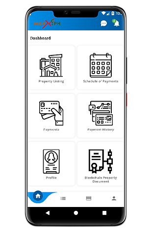
Mobile Apps for Real Property Owners
Real Property Tax Dues and Payment
Set your due date, be notified, and pay your taxes within the palm of your hands. All these made available by our mobile app.
Property Listing and Locations
Worried having more than one land asset? We got you covered. Our mobile app enables the user to list and tag the location of its assets for easier and faster tax mapping.
Tampered-proof RPU Document Archiving
Powered by the latest blockchain technology, the MapX mobile app enables documents to be tampered-proof and resilient to cyber-attacks.
We Have Come a Long Way
Gone are the days of tedious and cumbersome mapping and assessment. Not to mention, a quite handful of departments with intricate procedures and the waiting, the waiting on long queues just to pay your real property tax obligation. We understand how you feel!
At last, a panacea!
Be the first and experience the most convenient way of paying tax dues anytime and anywhere.
Book for a Demonstration Schedule
We want to hear from you!
Tel: +63-85-341-2786 loc 123 | Mobile: +63-917-812-7114
Navigatu-DOST-TBI, 2nd Floor CCIS Building, Caraga State University
Ampayon, Butuan City, Philippine 8600